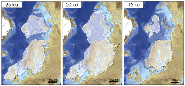
Our aim is to produce synchronous ice margin reconstructions, or time-slice maps, depicting the evolution of the Eurasian Ice Sheets (including the Scandinavian, British-Irish, Barents-Kara-Sea and Svalbard Ice Sheets) through the last glacial cycle 40,000 to 10,000 years ago.
The maps summarise the available geological evidence and therefore will provide a critical empirical test for results from numerical and isostatic ice sheet modelling. Our reconstructions include maximum and minumum bounds to represent all lines of geologcial uncertainty.