New insight on floods risk from the bottom of the lake
The Department of Earth Sciences (GEO) is part of HordaFlom, an innovative project which will analyze lake sediments to reconstruct flooding events during the last 2000 years and which will provide more robust projections of future floods

Main content
Floods are among the most severe natural hazards, causing devastation both in terms of human suffering and economic costs. They are associated with intense rainstorms, and/or by rapid melting of a snowpack accumulated on the mountains during the preceding winter. Western Norway has in the last 30 years experienced an increase in the amount of precipitation (32% in winter, 28% in spring and 14% yearly) and in their intensity with a consequent increase of the risk of floods. It is therefore necessary to get more knowledge about how much rainfall will increase during this century, and to what extent this will increase the risk of flooding.
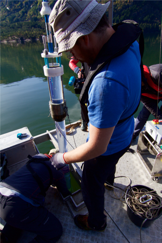
HordaFlom will use an innovative approach for calculating this risk in Western Norway. Researchers will reconstruct the flooding events of the last 2000 years through the analysis of sediment cores of three lakes (Vangsvatnet in the Voss municipality, Sandvinsvatnet in Odda municipality and Nesttunvatnet in the Bergen municipality). These new paleo records will extend the existing archive which today contains only floods observations from the last 50-100 years and will hence contribute to a better basis for calculations of floods recurrence intervals. Data will be also used to calibrate regional climate models to achieve more realistic projections for rainfall and flooding in the next century. HordaFlom will, for the first time, bring together researchers, municipalities and national authorities , when Bjerknes Center for Climate Research, GEO, Uni Research Climate and Uni Research Rokkan Centre, Bergen municipality and Norwegian Water Resources and Energy Directorate (NVE) will work together to assure an effective use of this new knowledge through concrete implementation processes and decision making. HordaFlom will run until 2021 and has a total budget of six millions NOK half of which have been funded by Regional research funds Vestlandet, (RFF west coast).
The project manager is Øyvind Paasche (Uni Research Climate and Bjerknes center for climate research. Jostein Bakke (professor at GEO) will coordinate the field work and sediment core analyzes in collaboration with Eivind Støren (senior Engineer at GEO), Øyvind Paasche, Helene Fjellheim (graduate student at GEO) and Fanny Johansson (PhD student at GEO). The analyses will be performed in the new GEO national infrastructure Earth Surface Sediment Laboratory (EARTHLAB). The state of the art equipment available at EARTHLAB allows the high definition analysis of sediments enabling flooding events reconstruction at seasonal level. These new records will be integrated into the actual flooding events archive. Kolbjørn Engeland and Ida Steffensen, from the NVE, will be responsible to develop statistical methods to allow the integration of these two different sets of data The resulting extended archive will be used by Erik Kolstad from Uni Research Climate and Bjerknes Centre, to reduce uncertainty and increase the robustness and reliability of regional climate models and to achieve more realistic projections for rainfall and flooding in the next century.
Such information is critical for climate adaptation and planning new infrastructure and it is therefore imperative that the knowledge about flood risk is implemented in municipal development and decision making. In HordaFlom Simon Neby (UNI Research Rokkansenteret) and Jørgen Gullestad, (Section for Civil Protection and Emergency Planning, Bergen municipality), will assure close coordination and communication between researchers, administrators and policy makers and will follow actual adaptation processes in Bergen, Odda and Voss municipalities.
With its cross-disciplinary approach, the group’s expertise and the cutting-edge infrastructures, HordaFlom has all the potentials to provide Western Norway municipalities with new knowledge base for decision about flooding, flood protection and climate adaptation.
We are looking forward for the first results!
