Assessing rock glaciers for their hydrological significance in the Semi-Arid Andes
Hovedinnhold
Project description
The cryosphere plays an important role in regional hydrology in many parts of the world as the seasonal melting of snow and ice helps to sustain streamflow and fill aquifers. The cryosphere is hydrologically important for an estimated 0.3 billion people living in mountainous regions worldwide and a further 1.3 billion people living downstream. During drought years glacial melt can be the dominant contribution to streamflow in some regions and is a vital buffer against water scarcity. The cryosphere is however in a state of global rapid change, with 267 ± 16 gigatonnes of glacier mass loss annually between 2000 and 2019, and 78% of mountain areas exhibiting a decrease in the duration of annual snow cover in the past decades. Such changes will impact the magnitude and seasonality of regional hydrology. These effects will be most pronounced in semi-arid and arid environments where the cryospheric contribution to annual streamflow can be as high as 85%. While in the short-term cryospheric losses are likely to increase dry-season streamflow, ‘peak water’ is expected to be reached in many regions by 2100. As the glacial input to semi-arid catchments decreases, the input of water from other sources such as rock glaciers becomes of higher relative importance.
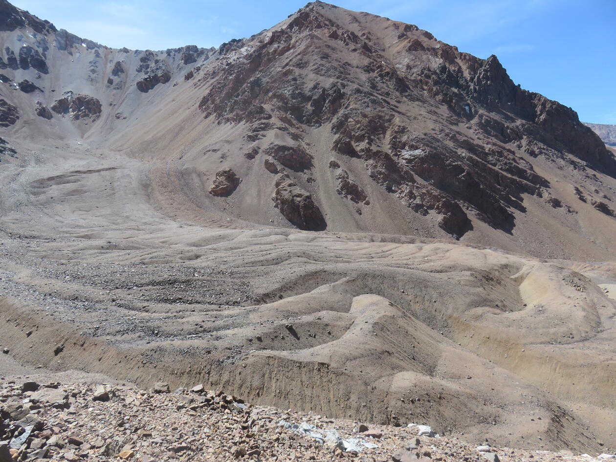
Rock glaciers are tongue shaped landforms found in permafrost conditions, and consist of poorly sorted, angular debris and ice-rich sediments formed by gravity-driven permafrost creep due to the deformation of internal ice. Although uncertain, first estimates put a near-global water volume of rock glaciers at 62.02 ± 12.40 Gt with their hydrological importance greatest in the Central and Eastern Himalaya and South America. Rock glaciers are likely to be an important component of future hydrological budgets as they are more resilient to climate warming than clean-ice glaciers.
There is a need to better understand the hydrological significance of rock glaciers in order to assess their potential as water resources. This project will combine remote sensing techniques, with field surveys and running existing surface energy balance models to determine how rock glaciers have changed over time, which rock glaciers are likely to contain more ice, and under what situations a rock glacier is more resilient to climate change.
Proposed course plan during the master's degree (60 ECTS):
GEOV316 – Remote Sensing
AG-330 Permafrost and Periglacial Environment (Summer School, UNIS)
GEOV325 Glaciology
Prerequisites
Previous experience with GIS or Remote Sensing (for example GEO215/GEOV205). Previous experience with python (such as INF100) is an advantage but not a requirement
Field- lab- og analysis
Funding is available for fieldwork in Chile both after the summer school, and in 2023.
Supervisors
Ben Robson
Ann Rowan
Shelley MacDonell (University of Cantebury)