Landscape evolution modelling of late Mesozoic topography and sediment output from Southern Norway
This Master's project was assigned to Aleksandra Danielsen who started the Master's program in Earth Sciences, UiB, in the spring semester 2024. The Master's project is given by the research group Geodynamics and basin studies.
Main content
Project description
Precipitation in elevated regions creates flow of water or ice that erodes the existing landscape and transports sediments to depositional areas. Traditionally, geoscientists have either focused on investigating how the sedimentary record evolved, without considering information from the source, or how topography evolved, without considering information from the sedimentary record.
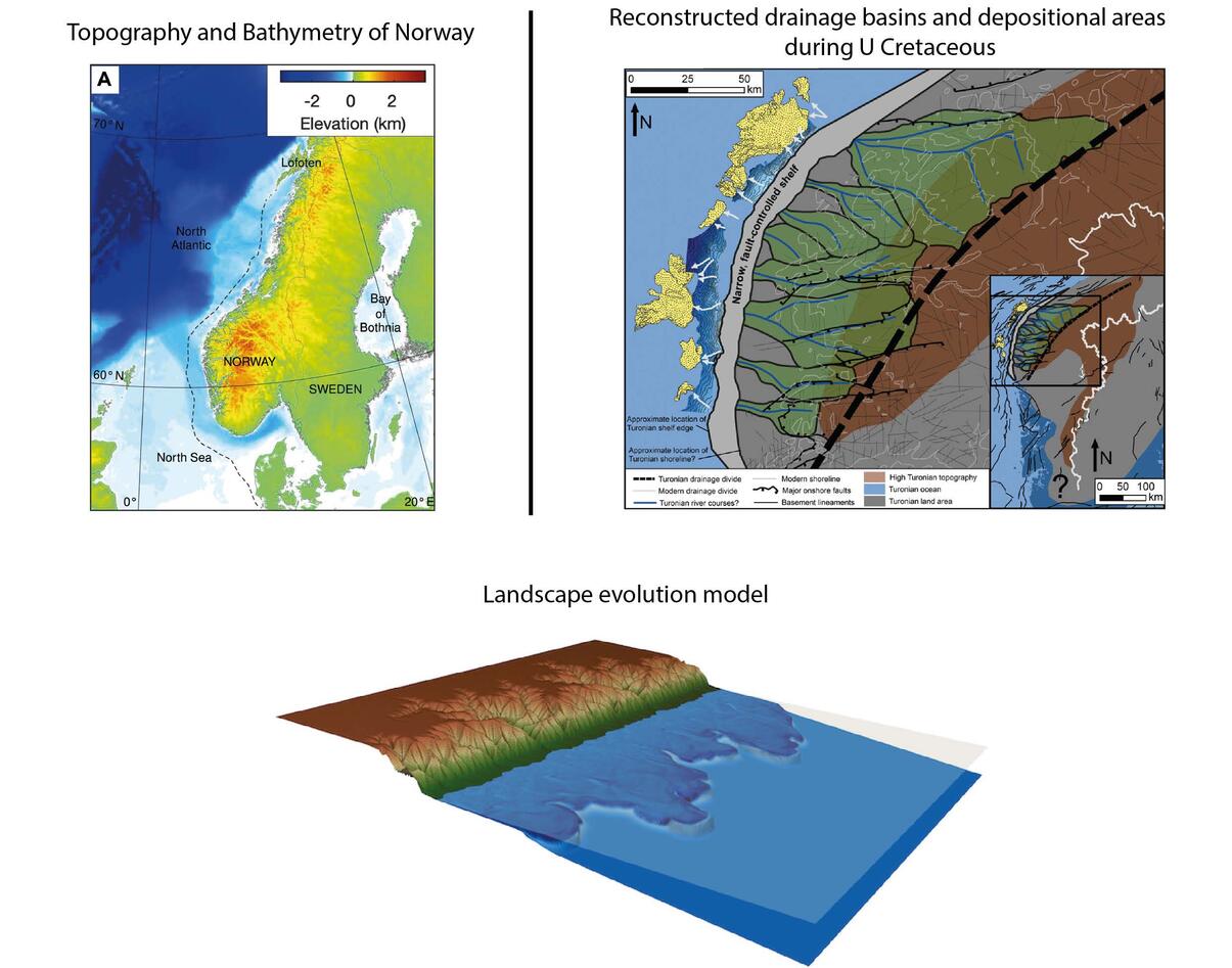
The evolution of topography in Norway is matter of substantial controversy surrounding the origin and evolution of high topography – was topography always high or did it vary considerably through time? The present day crustal thickness in Southern Norway suggests long lived topographic relief originating from the Caledonian mountain belt. However, the absence of erosional input to the Norwegian offshore basins and deposition of fine-grained chalk deposits during the late Cretaceous (90-65 Ma) are difficult to reconcile with significant relief that is expected to have produced a significant amount of clastic sediments.
This project aims to bridge the gap between observations from the sedimentary record in the Norwegian offshore basins, and evolution of topography in Southern Norway. To investigate the combined evolution of topography and sedimentary deposits, you will use landscape evolution models and test contrasting scenarios for topography and associated erosion and sediment export during the late Mesozoic. Modelling will use an existing landscape evolution model called FastScape (https://fastscape.org/), written in the programming language Fortran90 or Python. This project is aimed at geophysics or geology students that don’t shy away from programming and have an interest in solving geodynamical problems combining forward modelling with offshore seismic and well data. Some code development and code modifications will be required.
Doing this Master’s project, you will learn how to think geosciences in a quantitative way and use programming and modelling techniques to solve a research question.
Proposed course plan during the master's degree (60 ECTS):
To be decided with the candidate depending on her/his background (geophysical or geological). Geodynamics and Basin Modelling, Computational Methods, Sedimentary System Dynamics, Structural Geology, Geoinformation Systems are among the topics to consider primarily.
Prerequisites
The proposed project targets students with both geophysical or geological background and a strong interest in quantification of geological processes, combining data and modelling. The candidate is expected to have taken INF100 or a similar course.
Felt- lab- og analysearbeid
This thesis does not require any field- or lab- work.
Student
Aleksandra Victoria Gusfre Danielsen
Supervisors
Ritske Huismans
Tor Sømme UiB/Equinor
Sebastian Wolf