Active projects
Information about currently active archaeological field projects sponsored by the Norwegian Institute at Athens

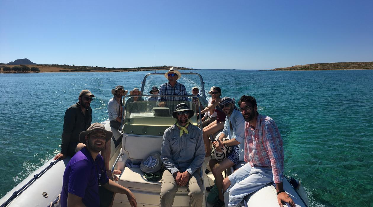
A survey team in action in the Cyclades
Photo:
Z. Tankosic
Main content
- The Small Cycladic Islands Project (SCIP)
- Gourimadi Archaeological Project (GAP)
- Apalirou Environs Project (Norwegian Naxos Survey)
THE SMALL CYCLADIC ISLANDS PROJECT (SCIP)
- SCIP began in 2019 as a collaborative project jointly organized by the Ephorate of Antiquities for the Cyclades (Greek Ministry of Culture and Sports), the Norwegian Institute at Athens, and Carleton College (USA). The project consists of a 3-year-long archaeological surface survey of small currently uninhabted Cycladic islands. These islands, chiefly smaller than 1 square kilomerer, play a negligible role in the present-day socioeconomic life of the Cyclades. In the past, however, they were an integral and important part of the life on the islands and served multiple roles, such as reservoirs of additional arable land or pastures, places for refuge/defense, and as stepping stone in durig maritime voyages. SCIP is designed to explore and record the diachronically and geographically varried apsects of their use and reconstruct the patterns of habitation/utilization of these important localities. In 2019, the focus of the project was on the small islands around Paros and Antiparos. More info on the project's web site.
***
GOURIMADI ARCHAEOLOGICAL PROJECT (GAP)
- Gourimadi Archaeological Project (GAP) includes the systematic excavation of a Late Neolithic-Early Bronze Age site near Karystos in Southern Euboea. The project is organized by the Norwegian Institute at Athens and is conducted under a permit from the Greek Ministry of Culture and Tourism (ΑΔΑ: ΩΨ6Ι4653Π4-ΠΑ3) with the supervision of the Ephorate of Antiquities of Euboea. The project is directed by Dr. Žarko Tankosić and co-directed by Drs. Fanis Mavridis and Paschalis Zafeiriadis.
The site
- The site of Gourimadi lies on the outskirts of the Katsaronio plain, about 6 km from the modern town of Karystos in southern Euboea. The prehistoric habitation extended over a natural hill with excellent defensive properties and a key position in the local landscape, which offered unobstructed vistas not only of its immediate surroundings but also of the neighboring regions of eastern Attica and the northern Cyclades (Andros, Tinos, Mykonos, Giaros, and Kea). The distribution and surface density of the artifacts collected from the site during its survey (NASK 2012-2017) suggested that the prehistoric occupation stretched mostly on the top flat part of the hill and on its southern slopes, and to a lesser extent on its northern and western slopes. The effect of prolonged erosion has been a decisive factor in the current surface densities of the prehistoric material.
The 2018-2019 excavations
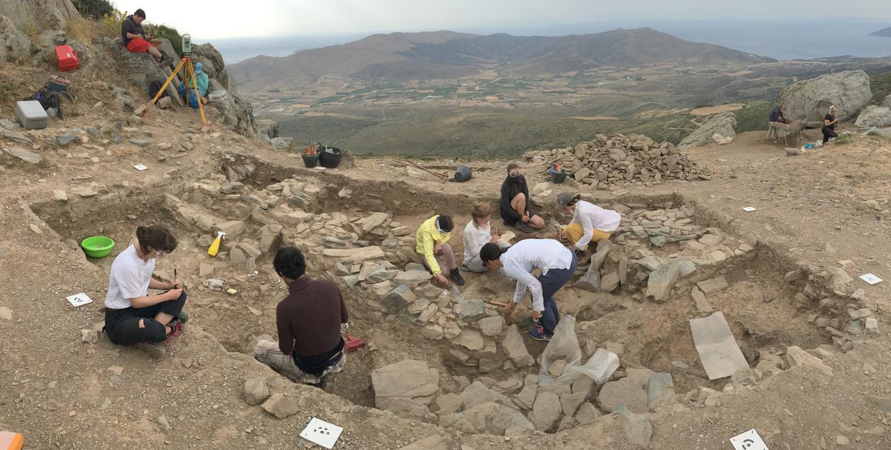
- The 2018-2019 excavations consisted of two trenches, none of which has reached the natural bedrock. Trench 1 (7 x 4 m) takes over a large section of the top flat part on the summit of the hill, while Trench 2 (4 x 4 m) lies about 5m to the south of Trench 1 and occupies its southernmost section. Before excavation, the summit was once again systematically surveyed, and all parts of the hill were plotted in a georeferenced grid system. The position of the trenches follows the established grid.
- The excavation methodology employed in GAP is based on the removal of stratigraphic units (termed ‘excavation units’) which wherever possible correspond to natural and anthropogenic episodes of archaeological deposition. For faster and more precise measurements, a Total Station device was used throughout the excavation procedure (planning, excavating, and recording), including all elevation points taken for moveable artifacts, architectural features, and excavated units. All the excavated soil was dry-sieved and standardized flotation samples were systematically collected from each excavation unit. Finally, besides keeping a handwritten field journal, all recording (excavated units and their specifications, unearthed features, all artifactual categories, coordinates, etc.) was paperless and was logged in customized digital forms running on android tablet-based software (ODK Collect).
The finds
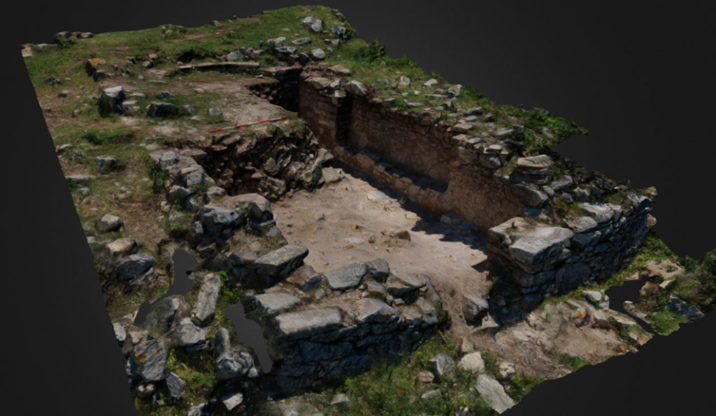
- Excavation in the two trenches has yielded some notable architectural and moveable finds. Architectural remains, which almost exclusively came from Trench 1 in 2018-2019, consist of rectilinear and curvilinear stone-built walls, which probably defined both roofed and open-air spaces. At then current stage of the excavation we were unable to offer a certain interpterion of their function or how they relate to each other. However, the position of the walls at different stratigraphic levels and their careful construction indicate the prolonged habitation of the site. Other excavated features include two stone-built benches, refuse pits, a thermal installation (oven), and a surface/floor created by successive episodes of domestic byproducts discard. Finally, an extensive destruction layer of heavily burnt daub was uncovered in the southern half of Trench 1.
- Moveable finds from both trenches include large amounts of pottery and chipped stone artifacts almost exclusively made of Melian obsidian. Other findings include ground stone tools, two stone-made beads, two anthropomorphic figurines, and small quantities of poorly preserved animal bones. So far, a fragmented skull recovered from the northern half of Trench 1 is the only verified human remain from the site. The four pieces of slag from the upper levels of Trench 2 is another unique find of the 2018-2019 seasons that requires further scrutiny. It is noted that the volume of excavated material from Trench 1 is significantly higher compared to Trench 2.
- Pottery represents the most plentiful find category from the 2018-2019 field seasons. Pottery shapes include closed, open, and openmouthed vessels. The preliminary study of the ceramic assemblages from 2018 suggests (based on morphological, stylistic, and decoration criteria) the division of the relevant material into three discrete periods, as these are broadly defined within Aegean prehistoric research. Most of the 2018 pottery can be assigned to the timespan between the end of the 5th millennium B.C. and the 4th millennium B.C. and shows strong affinities with material from sites such as Ftelia on Mykonos and Kephala on Kea. A few ‘white-on-dark’ specimens reminiscent of the mid-5th millennium so-called Saliagos horizon in the Cyclades consist perhaps the most notable ceramic find so far. These sherds place the beginning of occupation on the site to the Late Neolithic (LN) period and, thus, make Gourimadi the earliest known open-air settlement in southern Euboea. Finally, a small number of sherds belong to rolled-rim vessels and vessels with T-shaped rims, indicate the occupation/use of the site during the Early Bronze Age (EBA) I period.
- Chipped stone tools, predominantly made of Melian obsidian, constitute an equally important and voluminous part of the Gourimadi archaeological assemblage. More than 5000 pieces of Melian obsidian, both final tools and debitage of their production sequence, were excavated in the 2018 season alone. The most notable observation concerning this assemblage is the very large and continuously increasing number of arrowheads (concluding with 2019, there are more than 130 either excavated or collected during the previous survey of the site), which is the largest collection of this sort in southern Euboea and one of the largest in the Aegean. The preliminary analysis of the lithic assemblage indicated the presence of all the stages of the reduction sequence and large quantities of debitage, which is indicative of extensive on-site reduction. Furthermore, numerous characteristic pieces such as cortical flakes and technical pieces suggest that the obsidian raw material was imported in Gourimadi in the form of unprepared nodules. All considered, the site appears to have played a central role in the production of artifacts made of obsidian at least on a local/regional level.
Some tentative observations
- Given the preliminary stage of research in Gourimadi, we are still unable to speak with confidence about the character of the site nor the exact use of the structures/walls we uncovered. The dimensions and the construction details of the stone-built walls, coupled with their complicated vertical and horizontal sequence, suggest that we are dealing with a type of settlement with successive architectural episodes and prolonged occupation history that might stretch over different prehistoric periods. Also, the study of the lithic assemblage indicates the importance of the Melian obsidian industry in the economy of the settlement, which, based on the volume and the morphological specifications of the excavated material, could have played a crucial role in regional networks of production and circulation of obsidian artifacts.
The gratitude
- Many individuals and organizations have in various ways assisted with the organization and conduct of the Gourimadi Archaeological Project and, sadly, we cannot do them justice by mentioning them all here. This, however, does not reduce the gratitude we owe them. We would particularly like to thank the Norwegian Institute at Athens, for the permit and financial support as well as the Institute for Aegean Prehistory (INSTAP) for their generous funding. Our work would not have been possible without the support of the Ephorate of Antiquities of Euboea and its current and former directors, Drs. Angeliki Simosi and Pari Kalamara, respectively, as well as archaeologists Fani Stavroulaki (the Head of the Department for Byzantine and Post-Byzantine Antiquities of the same Ephorate) and Kostas Boukaras. We thank the Glenn Black Laboratory of Archaeology at Indiana University for lending us the necessary magnetometric equipment and our colleague Dr. Elizabeth Watts Malouchos from Indiana University Anthropology Department for operating it in the field. Finally, we owe a great debt of gratitude to the local community for their support, and particularly to the Mayor of Karystos, Mr. Lefteris Raviolos, and the staff of the Karystos Museum, Ms. Sofia Stambelou and Ms. Evangelia Athanasiou.
The GAP People
- We thank our friends and colleagues Aikaterini Psoma (lithics specialist), Dr. Denitsa Nenova (IT; database; topography; excavator; illustrator), Aikaterini Kanatselou (trench supervisor), Paschalis Delios (trench supervisor; museum team), Hüseyin Öztürk (trench supervisor; UAV operator), Stamatis Vogiatzopoulos (museum team), Aca Đorđević (excavation; draftsperson), Dr. Aleksandar Kapuran (excavation; draftsperson), Kostas Nikolaou (water-sieving supervisor), Jonida Martini (trench supervisor), Giorgos Agkavanakis (conservator); Giorgos Hatzitheodorou (topography); Dimitris Lambropoulos, Dr. Flint Dibble (zooarchaeology), and Laura Magno (geoarchaeology) for their help during the excavation and study process. The project has been made possible and enjoyable thanks to our amazing team consisting of student volunteers from Norway, Greece, United States, and the Netherlands.
List of participanting students (BA, MA, and PhD level) 2018-2020:
- 2018: Elisabeth Aslesen, Weronika Polanska, Nadia Giagkoudaki, Luka Jandric, Magnus Eiterjord, Kathrine Wehmer, Martine Petlund Breiby, Kathrine Christoffersen, Sara Hagfors, Tora Fougner-Økland, Merel van der Wees, Marianna Psyrri Larsen; 2019: Elisabeth Aslesen, Weronika Polanska, Luka Jandric, Amanda Pedersen, Josefine Elders, Isabel Finstad, Merel van der Wees, Aksel Teigen Breistrand, Malene Solheim; 2020: Elisabeth Aslesen, Bendik Bergendal, Merel van der Wees, Irene Ekren, Serina Griffioen, Cecilie Vanvik, Linn Halvorsen, Lorentz Haugen, Eystein Listhaug, Molly Wadstål.
***
APALIROU ENVIRONS PROJECT (NORWEGIAN NAXOS SURVEY)
- The Norwegian Naxos survey started in October 2010 with a campaign to survey and record the archaeology of Kastro Apalirou: The fortified mountain town that might have functioned as the capital of Naxos in the mid to late Byzantine periods. The project is a collaboration (synergasia) between the Norwegian Institute (University of Oslo) and the Ephorate of Antiquities for the Cyclades. The project is also joined by teams from the Universities of Newcastle and Edinburgh.
About the project
- The survey focuses on how economic and political changes can be seen in the landscape, and in particular the changes that occurred from the Middle Byzantine period (565 -1081 AD) to the Venetian period (1206-mid 16th century AD).
Objectives
- The main objective of the survey is to map and document Kastro Apalirou and to understand the relationship between settlement patterns, political authority and the economy of the island. The first task is to document the extant remains on Kastro Apalirou, which are made up of a fortified circuit wall, over 40 cisterns some of which are exceptionally large, a religious-complex, and numerous buildings. The main structures have been recorded by total station survey, and a plan of the site has been built up. A photographic survey has been made and extensive field notes have also been taken. In order to understand the function and form of the kastro there are several questions concerning the political, administrative and religious structure of Naxos that need to be answered. What functions did Apalirou have? Was it a refuge for the secular elite in times of threat? Or was it settled over longer periods? Was Apalirou a defensive site for Naxos alone? Or did it perform a wider role in the Cyclades? Whilst the main objective and focus is Kastro Apalirou we intend to expand our field work to the surrounding landscape and create a laboratory of historical and archaeological research on the transition from Antiquity to the Middle Ages.
Background
- The island of Naxos in the Cyclades has for long been renowned for its rich Byzantine heritage, and in particular the numerous, decorated churches. The settlement pattern of Byzantine Naxos has been far less studied, although some important centers have for long been known and structures are indeed still visible. In 2010 an archaeological team from The Museum of Cultural History and the Department of Archaeology, Conservation and History at the University of Oslo initiated a pioneer project of mapping and documentation of the most important of these centers, Kastro Apalirou.
- In the aftermath of the 4th Crusade, the Venetian Marco Sanudo in 1206 or 1207 landed on Naxos and immediately laid siege to what seems to have been the main Byzantine fortress on the island, Kastro Apalirou.After a five-week siege, Sanudo conquered the site, took over the island and later expanded his realm to the neighboring islands to create a Venetian and Catholic Duchy in the central Cyclades. The Venetian conquest was followed by a feudal reorganization of the islands.When Kastro Apalirou was founded as the main fortified centre on Naxos is another and far more difficult question to answer. Since it is evident that this fortified hilltop site in the interior is far easier to defend than any coastal settlements on Naxos, a foundation in the 7. - 8.th century AD seems possible, at a time when the Byzantine empire had largely lost her supremacy at sea. Raiding and piracy grew out of control and as a consequence many coastal regions and islands in the Aegean were depopulated and left deserted until stable conditions returned.
Read more at the website of the University of Oslo.
***
05.01.2022


