Can intertidal areas along rocky coasts keep up with sea level rise?
This Master's project was assigned to Ellen Milada Fagermo who started her Master's program in Earth Sciences, UiB, in the spring semester 2024. The Master's project is given by the research group Quaternary geology & paleo climate.
Main content
Project description
Inter tidal areas are areas that fall dry during low tide. The intertidal areas are valuable ecological areas, containing unique flora and fauna. Sediments usually consists of soft sediments such as mud and sand.
In the next hundred years increased sea water levels are expected (IPCC, 2021). The question is if these importantinter tidal areas are drowned by increased sea levels or if they have enough sediment supply to grow with the sea level and survive. Studies on e.g. salt marshes have been done in sediment rich environments (e.g. Best et al, 20xx), but studies are lacking on rocky coasts with (probably) less sediment supply. Fluvial supply of sediment can also change due to climate change (e.g. increased extreme rainfall). Another factor are anthropogenic influences such as damming rivers.
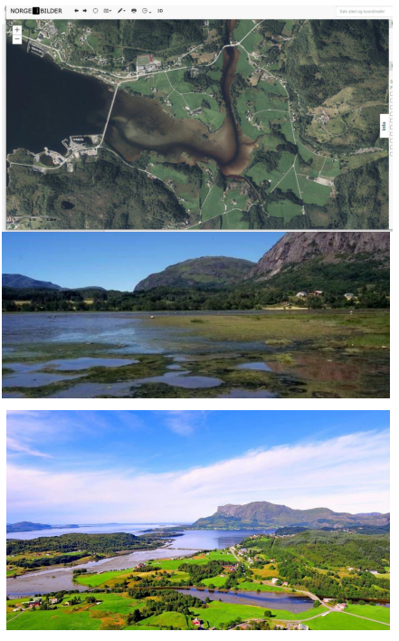
Askvika in Askvoll kommune, is an estuary and an important intertidal area in Vestland, Norway. The area is in direct contact with the seas and tides are coming in daily. The area consists of muddy material. The government self identifies sea level rise as a potential threat to this nature area.
https://www.statsforvalteren.no/nn/Sogn-og-Fjordane/Miljo-og-klima/Verne...
Research questions:
• Can inter tidal areas along rocky coasts survive the predicted sea level rise in the next hundred years?
• What kind of inter tidal areas can survive and/or how do they change? Beach, Estuary, Delta.
Proposed course plan during the master's degree (60 ECTS):
GEOV223 (10)
GEOV229 (10)
GEOV261 (10)
GEOV300 (5)
GEOV302 (10)
GEOV345 (5)
GEOV360 (10)
Field- lab and analysis
- Field work: Identify the sediment types and origin (marin/fluvial); measure driving forces that can move sediment around (tidal currents/ fluvial input / waves); evt. take bed level heights/depth
- Modelling: Make a hydrodynamic/morphodynamic model to model future changes due to sea level rise.
Student
Ellen Milada Fagermo
Supervisors
Prof. William Helland-Hansen
Gerard Dam, Asplan Viak